Maremma and the Etruscans
The Tuscany of Grosseto, Saturnia, Orbetello, Capalbio and the Argentario

Maremma, the area of Tuscany which was once the heartland of the Etruscans, stretches along the Southern Tuscan coast and inland to the towns which the area's first inhabitants carved out of the tufo rock.
Take a walk on the wild side
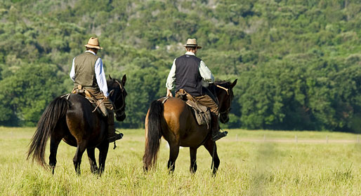
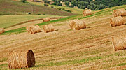
For centuries the swampy coast of Maremma was infested with malarial mosquito and inhabited only by charcoal burners, shepherds and cowboys, the "butteri".
It was not until 1950 that the malarial mosquito was eliminated. As a result, this is one of the most unspoiled stretches of the Italian coastline!
Tuscan lagoons
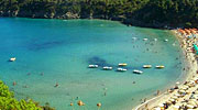
Travelling south from Grosseto you reach the Parco Naturale della Maremma, home to many resident, migrating and nesting birds. The forest-covered hills give way to grasslands, where the "butteri" ride their half-feral horses, and to beautiful beaches.
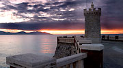
From the park, the Via Aurelia Etrusca leads to the mouth of the Albegna River and to the Tombolo di Giannella, a sand spit which joins Monte Argentario, once an island, to the mainland.
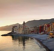
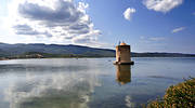
The Laguna di Ortobello was formed by a sandspit. The Romans constructed a causeway across the lagoon to reach Orbetello, town which had been divided from the mainland by the lagoon.
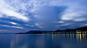
The sheltered and shallow lagoons, draw hundreds of species of birds here each year, thus offer amazing bird watching opportunities
From the coast to inland Maremma
As you head inland , make sure to visit the hill-village of Capalbio, with its perfectly intact medieval centre and fortifications constructed by the legendary war lord Albrandeschi. From the summit of the hill beautiful views of Capalbio beach and the Burano lagoon can be seen.
From Capalbio the road travels deep into the hills of the Maremma to the land of the Etruscans and the ancient cities made in Tufo.
A volcanic porous rock, for centuries tufo was used as a building material or hollowed out to form tombs, cellars and sunken pathways
Little Jerusalem
As you approach from Manciano, the cliff-top town of Pitigliano soars above you, its quarters linked by the arches of a medieval aqueduct. Etruscan tombs pock the cliffs.
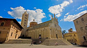
The town is dominated by a fortress, the cellars of which now house a museum. Behind the fortress, from the beautiful Piazza della Republica there is a stunning view. Via Zuccarelli brings you to a synagogue and old Ghetto
Known as "Little Jerusalem", Pitigliano once had had a thriving Jewish community, established in the 16th century by Jews fleeing the Papal States
Although most of the Jews who survived Nazi occupation have now emigrated, their influence, particularly in the cuisine, is still felt here.
The rise and fall of Sovana
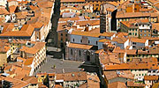
The ancient capital of this part of the Maremma and once a rival to Siena, Sovana is now a little village sporting a number of attractive ancient ruins. An important medieval town, Sovana started to decline during the 14th Century. The reason? The town's low lying position made it vulnerable to Malaria - and the Sienese.
North of the town, the Etruscan Necropolis contains over 100 tombs. The most spectacular tomb, the Tomba di Sileno, was discovered in 1963.
Etruscan spa town
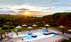
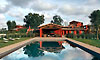
East of Sovana lies the hill town of Saturnia, famous today because of its Spa complex which grew up around the sulphur springs, waterfalls and streams which have drawn those seeking a panacea for their ailments for more than 3000 years.
The Etruscans who built the town, are thought to have used these surreal bubbling turquoise waters in sacred rites
Itineraries
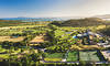
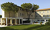
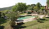
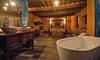
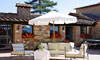
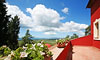
Hotels in the area